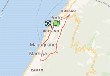
![](/images/other/stat-length.png)
![Tocht Te voet Brenzone sul Garda - Percorsi tra il bosco e gli ulivi - Photo](https://media.geolcdn.com/t/1900/400/5b4d10a5-709f-4da0-99d7-13f49baaf5e2.jpeg&format=pjpeg&maxdim=2)
Percorsi tra il bosco e gli ulivi
SityTrail - itinéraires balisés pédestres
Tous les sentiers balisés d’Europe GUIDE+
![Lengte](/images/other/stat-length.png)
![Max. hoogte](https://static1.geolcdn.com/siteimages/upload/files/1508320355ic_sort_altitude_max_24dp.png)
![Positief hoogteverschil](https://static1.geolcdn.com/siteimages/upload/files/1508320355ic_sort_den_pos_24dp.png)
![Km-Effort](/images/other/stat-length.png)
![Min. hoogte](https://static1.geolcdn.com/siteimages/upload/files/1508320355ic_sort_altitude_min_24dp.png)
![Negatief hoogteverschil](https://static1.geolcdn.com/siteimages/upload/files/1508320355ic_sort_den_neg_24dp.png)
![Boucle](https://static1.geolcdn.com/siteimages/upload/files/16400158638029165_repeat_loop_refresh_sync_direction_icon.png)
![Te voet](https://static1.geolcdn.com/sitytour/trail-icons/100.png)
2h12
Moeilijkheid : Gemakkelijk
![Scan deze QR-code om de tocht te openen in de SityTrail-applicatie](https://capi.geolives.com/qq0zvz2zws4bq2lad0pu/sitytour/trails/3118533/qr.png?size=200)
Gratisgps-wandelapplicatie
Over ons
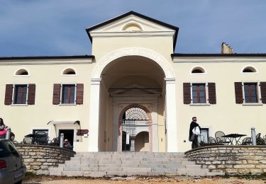
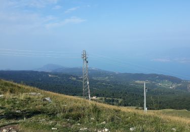
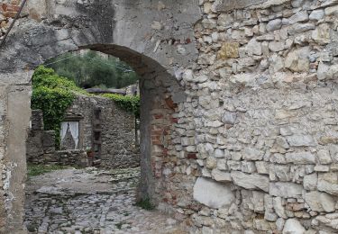
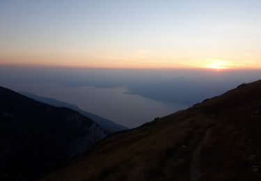
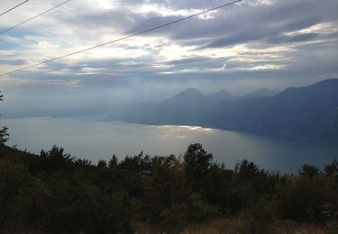
Tocht Te voet van 5,3 km beschikbaar op Veneto, Verona, Brenzone sul Garda. Deze tocht wordt voorgesteld door SityTrail - itinéraires balisés pédestres.
Beschrijving
Scopri gli itinerari del Nordic Walking Park, Le Vie dei Monti e Sentiero Natura di Sommavilla. Regalatevi una indimenticabile esperienza a Brenzone.
Website: http://www.brenzonetrekking.eu/
Plaatsbepaling
Opmerkingen
Wandeltochten in de omgeving
![Tocht Te voet Brenzone sul Garda - Castelletto di Brenzone - Prada - Bocchetta di Naole - Photo](https://media.geolcdn.com/t/375/260/8b431f74-dbc1-4936-94f1-3f7a58c41920.jpeg&format=jpg&maxdim=2)
![Te voet Te voet](https://static1.geolcdn.com/sitytour/trail-icons/100.png)
Te voet
![](/images/other/stat-length.png)
![](https://static1.geolcdn.com/siteimages/upload/files/16400158638029165_repeat_loop_refresh_sync_direction_icon.png)
![Tocht Te voet Brenzone sul Garda - Castelletto di Brenzone - Prada - Photo](https://media.geolcdn.com/t/375/260/f2f604a5-834c-4ba2-88b8-da60121650ff.jpeg&format=jpg&maxdim=2)
![Te voet Te voet](https://static1.geolcdn.com/sitytour/trail-icons/100.png)
Te voet
![](/images/other/stat-length.png)
![](https://static1.geolcdn.com/siteimages/upload/files/16400158638029165_repeat_loop_refresh_sync_direction_icon.png)
![Tocht Te voet Tignale - Oldesio (Tignale) - Campione (Tremosine) - Photo](https://media.geolcdn.com/t/375/260/7ca28d47-77e0-44fe-99e6-2a11c68bc4c8.jpeg&format=jpg&maxdim=2)
![Te voet Te voet](https://static1.geolcdn.com/sitytour/trail-icons/100.png)
Te voet
![](/images/other/stat-length.png)
![](https://static1.geolcdn.com/siteimages/upload/files/16400158638029165_repeat_loop_refresh_sync_direction_icon.png)
![Tocht Te voet Tignale - Aer (Tignale) - Passo di Fobia - Photo](https://media.geolcdn.com/t/375/260/0a830875-6afb-4677-b03a-92a2300d1463.jpeg&format=jpg&maxdim=2)
![Te voet Te voet](https://static1.geolcdn.com/sitytour/trail-icons/100.png)
Te voet
![](/images/other/stat-length.png)
![](https://static1.geolcdn.com/siteimages/upload/files/16400158638029165_repeat_loop_refresh_sync_direction_icon.png)
![Tocht Te voet Ferrara di Monte Baldo - Sentiero Lino Ottaviani - Photo](https://media.geolcdn.com/t/375/260/40102cc6-35a6-4843-82ae-c58a76e3f21b.jpeg&format=jpg&maxdim=2)
![Te voet Te voet](https://static1.geolcdn.com/sitytour/trail-icons/100.png)
Te voet
![](/images/other/stat-length.png)
![](https://static1.geolcdn.com/siteimages/upload/files/16400158638029165_repeat_loop_refresh_sync_direction_icon.png)
![Tocht Te voet San Zeno di Montagna - Percorso Marniga - Campo - Prada di Monte Baldo - Photo](https://media.geolcdn.com/t/375/260/5e0ca65a-60c9-4721-97e6-aee9c5bad6f7.jpeg&format=jpg&maxdim=2)
![Te voet Te voet](https://static1.geolcdn.com/sitytour/trail-icons/100.png)
Te voet
![](/images/other/stat-length.png)
![](https://static1.geolcdn.com/siteimages/upload/files/16400158638029165_repeat_loop_refresh_sync_direction_icon.png)
![Tocht Te voet San Zeno di Montagna - Sentiero Natura - Photo](https://media.geolcdn.com/t/375/260/2c3145a7-2acb-4104-b3cd-50a10a69a106.jpeg&format=jpg&maxdim=2)
![Te voet Te voet](https://static1.geolcdn.com/sitytour/trail-icons/100.png)
Te voet
![](/images/other/stat-length.png)
![](https://static1.geolcdn.com/siteimages/upload/files/16400158638029165_repeat_loop_refresh_sync_direction_icon.png)
![Tocht Te voet Malcesine - Cassone - San Maggiore innesto panoramica Malcesine - Photo](https://media.geolcdn.com/t/375/260/9586c757-ce43-486c-8c78-e9c35c2e3b7a.jpeg&format=jpg&maxdim=2)
![Te voet Te voet](https://static1.geolcdn.com/sitytour/trail-icons/100.png)
Te voet
![](/images/other/stat-length.png)
![](https://static1.geolcdn.com/siteimages/upload/files/16400158638029165_repeat_loop_refresh_sync_direction_icon.png)
![Tocht Te voet Brenzone sul Garda - Assenza - Rifugio Telegrafo - Photo](https://media.geolcdn.com/t/375/260/7182009a-9f8e-49c3-b9e9-e7b41654bdcb.jpeg&format=jpg&maxdim=2)
![Te voet Te voet](https://static1.geolcdn.com/sitytour/trail-icons/100.png)
Te voet
![](/images/other/stat-length.png)
![](https://static1.geolcdn.com/siteimages/upload/files/16400158638029165_repeat_loop_refresh_sync_direction_icon.png)